Kenny Klein with Stapler

Kenny Klein with Stapler
Showing posts with label katrina. Show all posts

Monday, September 24, 2012

The New Orleans Katrina Memorial


Hurricane Katrina is still present in every aspect of New Orleans life. It is as much a part of our culture and community here as is our speech, our streetcars, our bars and our music. It is as defining an event as the Civil War, Emancipation or Brown Vs. Board of Education: more so, as everyone here experienced it in their own lifetimes. If you want to strike up a conversation with anyone in New Orleans, you simply start by asking “were you here for Katrina?”

Often I don't even say the hurricane's name. It has too much emotional impact. I say “the storm.” My friends down here who bear that name have come to spell it with a C, Catrina; one friend goes by Karina. Some just go by Kat.

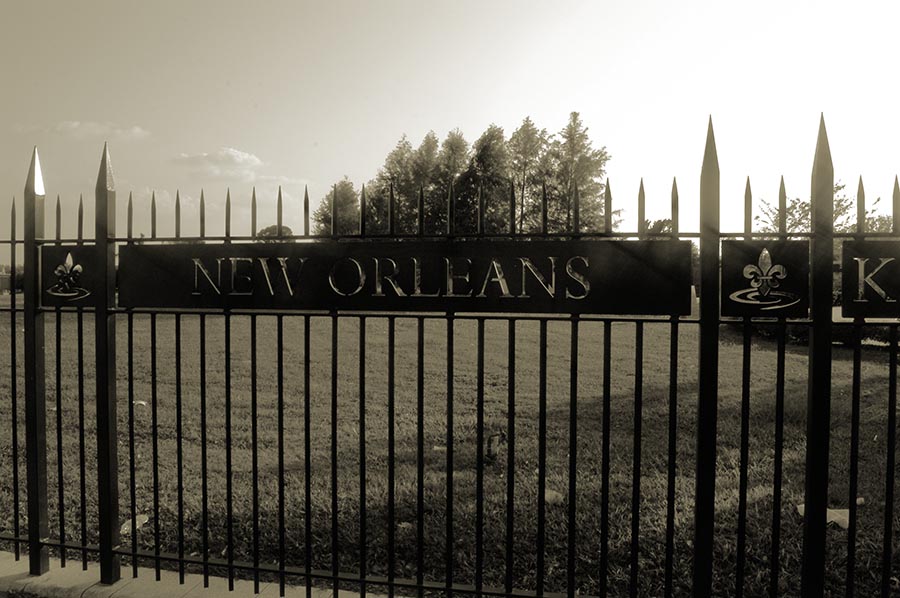
Back in May, just days before I left New Orleans to go on tour, Lauren and I were at a favorite cafe/headshop/herbal/botanica on Canal Street. The cafe portion borders Saint Patrick Cemetery, and as we had some time to kill, we decided to walk through the cemetery, which occupies sites on either side of Canal Street. When we crossed Canal, we found something new to either of us: the New Orleans Katrina Memorial, a tiny area wedged along the side of Saint Patrick. Armed with only my phone's camera, I took a few shots, unworthy of posting, and swore to come back after my tour to do a proper blog post on this very creepy, very beautiful shrine. 


Like many things Katrina, the shrine itself was built around emotional outpouring and heated controversy: though by 2008 the mayor's office had allotted a million dollars for the shrine to be built, and $200,000 more had come from private donations, as the third anniversary of the storm approached there was still no memorial, and 85 unidentified bodies were still unburied. But weeks before the 2008 anniversary of Hurricane Katrina, heaven and earth were moved, permits were pulled, and the memorial was built. On the third anniversary of Katrina, August 29, 2008, a jazz funeral second line marched along Canal Street; amidst weeping and a few sighs of resolution, the final seven unidentified victims of Katrina were carried to the memorial and interred. It was not until the following year that work was completed, and a marker stone laid.


The Katrina Memorial sits on a plot once used to bury the poor and indigent of Charity Hospital, and the gates of the memorial still carry Charity's name above them; along the edge of the gate is the current name, New Orleans Katrina Memorial. As one enters, a small reminder of Charity sits off to the side: a stone commemorating those who donated their bodies to scientific research upon their death. 


The memorial is built in a huge spiral, the shape of the hurricane itself as seen from the air. 

The spiral of the memorial, and neighboring Saint Patrick Cemetery #2, can be seen in the reflective surface of two of the crypts that house the unidentified Katrina dead. 


 At the center of the spiral, the hurricane's eye, sits a carved stone marker, which reads:

On August 29, 2005, Hurricane Katrina made landfall upon the Louisiana and Mississippi Gulf coast, bringing devastation to many communities. In New Orleans, storm surge and the failure of the levee system caused flooding in over eighty percent of the city, trapping thousands. In the chaotic aftermath New Orleanians faced desperate circumstances in homes, hospitals, the Superdome and other makeshift shelters. Despite the heroic efforts of first responders, medical personnel, volunteers and the military, over 1,100 citizens lost their lives in the disaster.

Most of the deceased were identified and buried by loved ones in private ceremonies throughout the nation. Here lie the remaining. The unclaimed and unidentified victims of the storm from the New Orleans area. Some have been forgotten. Some remain unknown.

This memorial is dedicated to these individuals and to all who suffered or died during Hurricane Katrina. Let the victims here forever remind us of those harrowing days and the long struggle to rebuild our city. Let their final resting place call us to constant preparedness. Let their souls join into an eternal chorus, singing with the full might of the indomitable spirit of New Orleans.

Jeffrey Rouse, MD, Chief Deputy Coroner
August 29, 2009


Around the marker sit stone benches, and beyond these, forming the outer spiral of the storm, are six crypts, the final resting places of the bodies of eighty-five victims of Katrina.  They are made of dark, reflective stone. One cannot sit or stand at the memorial without seeing one's own reflection, as well as the street beyond, the traffic, the bright red street cars: the constant reminders that New Orleans has been rebuilt; and that for the living, work continues, music is played, tourists visit, old men argue on the decaying sidewalk outside the liquor store, children in plaid uniforms hurry off to school: despite the best efforts of Katrina, life in New Orleans goes on. I am certain that those lying here take satisfaction in that.


The place is still, peaceful, as if the souls of those victims, unidentified for three years and finally mourned and interred with a jazz music second line, are now at rest. As I sat on a bench around the marker, preparing my camera equipment, a bird sat in the huge oak tree above the gates, singing to me. It sang for long minutes, a joyful song that rose above the sounds of traffic or the street car on Canal, just beyond the memorial gates. 

“Let their souls join into an eternal chorus...” the bird seemed to sing to me. And I thought: perhaps they have done just that.


The stone marker, benches, and reflective, spiraling tombs of the memorial. 


From the New Orleans Katrina Memorial on Canal Street, this is Kenny Klein explaining it all.

Tuesday, May 29, 2012

Life On The Levee

I have to apologize for not posting here for some time. I was being productive: I have a new CD coming out in just a few weeks, and a new book of my poetry, lyrics and photos has just been released, and is for sale as an e-book on Lulu dot com and on Smashwords. I'm getting ready to leave in just two days for my summer tour, a little torturous excercise I put myself through every year (see my schedule here). With all of this going on, I just haven't had time to post until now. Sorry.

Last time we took a tour of the French Quarter, looking at some of the lesser known sights. Today I want to talk about an area that is essential to New Orleans life. We are constantly surrounded by it, constantly aware of its importance in our world. It stands guard over us, nurtures us, and gives us recreation, economy and beauty. The one time it failed, 11,000 of us died. I'm talking about the New Orleans Levee.

A levee is a dam that holds back a body of water that is higher in altitude than the land around it. The New Orleans Levee is part of a system of levees that runs pretty much the entire length of the lower Mississippi River. Here in NOLA we have levees around the river itself, and around the various canals that were dug in the late eighteen and early nineteen hundreds to allow shipping from the river to enter Lake Pontchartrain.

I live just a few blocks from the levee (the part near my house held up during Katrina, thanks), and it is a pretty fascinating location: a combination of industry, recreation and wildlife, all functioning together in a sometimes uneasy partnership. It even contains a few mysteries...

Let's take a bike ride along the three or four miles of the levee closest to my house.


Nearly the entire length of the levee, from the French Quarter upriver to Metarie and Lake Pontchartrain, features a bike/jogging path. In the above shot, I set my bicycle beside the path to take a photo of the path and my bike with the river and the Huey P. Long Bridge in the background. As you can see, several bike riders passed through the scene as I was shooting, making for a dramatic pic.


Right in the spot where one enters it from my street there are 11 houses on the river side of the levee. This is the only place in New Orleans where houses sit on this side of the structure: while very romantic and picturesque, they are also in constant danger of flooding. I know them by color: the Blue House above, the Red House below, and the Natural Wood house somewhere down there.


Last year, after heavy snow melt and intense rain up north, the river rose about fifteen or twenty feet. Below are the same homes seen above, back in May of 2011. You can see that the Natural Wood House had flood waters inside the house, coming just over the floor, while the Red House was a little luckier (or a little higher): its yard was completely submerged.


Just across from the levee houses we find a working horse stable. Riders use the wide green lands on either side of the raised levee to ride, work and to graze their horses.


There are several beaches along the river. The largest one is just downriver from the levee houses. On the day I was there, there were sunbathers and people fishing, both pretty common activities (although this was the first time I saw a levee sunbather quite as bold as this one...take a close look at the photo below).


These two guys were fishing on the other end of the beach. A homeless guy walked by and told us he'd just seen an alligator a few yards away in the forest.


A lot of homeless people set up tents in the thickets along the levee. Here's a glimpse of the forest where the homeless and the gators dwell together. On my way to take these I passed through a tent village, but I didn't want to disturb their privacy: I shot a bit of the forest just beyond their camp.


I never did see the gator (though I know he's there---I can feel their presence on the levee). But wildlife abounds on the grassy structure: here's a little guy who was grazing just outside the forest.


Industry is everywhere on the river and the shore. While New Orleans has a booming tourist economy, like the rest of Louisiana our major industries are maritime: oil tankers, fishing and freight. I caught this oil tanker sailing upriver, passing under the Huey P. Long Bridge.


On the shore we find various shipping yards and salvage yards, like Bertucci, a salvage yard just on the other side of the levee houses. Here's a scene from that yard...


As I biked further upriver, a few miles past the salvage yard, I found a patch of forest. I locked the bike up and walked into this grove of cypress and oak, where I discovered a mystery that occupied my simple mind for several hours. Here is the forest that lured me in, with leaning cypress and tangled oaks. You can see from the marks on the cypress trees just how high the river has flooded in the recent past.


Deep in the forested area I found this stagnent, muddy course of water. The ground around the shallow murk was thick and wet, and had turned to quicksand (quicksand is sandy soil with water running beneath: it will suck you down pretty deep, as seen by the deep tracks left around the brackish water, but it's not like in the movies; you won't sink all the way in. it just kinda sucks for your shoes and your pants. Literally!).


Just to the side of the drying water flow, I found these structures. Obviously unused for many years, the forest growing into them, I wondered what they could be. My initial guess was that they were docks for barges or for tugs, unused because the river had once reached this area and had somehow receded. I even wondered if they were barges that were left aground when the river dried, and that became embedded in the silt and sand.


My girlfriend Lauren is much smarter than me, and every once in a while she has to remind me of that. She looked at these photos and solved the mystery. Can you guess? I'll give you one more look, and then reveal the somewhat obvious aswer Lauren revealed to me:


Lauren's solution to the mystery: New Orleans is full of canals. In the late eighteen and early nineteen hundreds, thousands of Irish workers were brought here to dig a series of canals. They all died of yellow fever, so Italians, immune to that disease, were brought over to replace them. This little course of mucky quicksand was once a barge canal! And the structures? Locks! Canal locks, to control the flow of water running through the chanel. Lauren is so smart...

So this got me thinking about canals. the following day I found myself in the Lower Ninth Ward, where I took the time to photograph the Industrial Canal that separates the Lower Ninth from the Upper Ninth Ward (built by those disease-free Italians in the late eighteen hundreds). The levee here is very open and grassy. Below is the view from the Levee into Holy Cross, the lowest end of the LNW, where some really beautiful houses stand. Holy Cross was not hit as hard by Katrina as the rest of the LNW, and many people are returning to this area to live. There is a lot of wildlife here too. Beside herons, egrets, hawks and eagles, there are hundreds of feral chickens.


The Industrial Canal unites the river and Lake Pontchartrain, a journey of five-and-a-half miles. Here is the spot where the canal meets the river. We see a tug pushing a barge from the Industrial Canal into the Mississippi.

Up the canal, at the center of the Lower Ninth Ward, the levee is really nothing more than a long, high concrete wall:


Here is the wall, seen from my car window as I crossed the Claiborne Bridge headed back uptown. That's the Florida Avenue bridge in the background, just down from the lake.


This concrete wall is the reason the flooding was so horrible in the Lower Ninth during Katrina. The levees were built to protect NOLA from the river rising. But no provision was ever made for water coming from the other way! On August 29, 2005, the storm flooded the river and the canals so badly that the lake rose and sent water back into the canals. Water coming south from Lake Pontchartrain overran the canals, and these flimsy concrete walls were no protection. They ended up like this:


(Photo above courtesy of this site).

What is being done to prevent this from happening again? All along the levee vacuum pumps are being installed. Here are the ones that stand just up the street from my house:


They're very Steampunk! These pumps can drain water from the river and divert it to flood chanels flowing away from the city. Also, safeguards are being built on the Pontchartrain end of the canals, locks that can be closed if the lake ever rises again (and it certainly will, we all know that). Hopefully the scene below will never happen again!


That placid beach full of grazing horses and lovely sunbathers? This was the same beach in May of 2011.


Wanna see the Levee yourself? To get to my end of the Levee from the French Quarter, just take the Saint Charles Streetcar line to Riverbend (right now it's the final stop until they finish fixing the upper tracks), get out and walk in the direction of the rising green slope. You're there! And don't worry, the beach is lovely right now (though I cannot guarantee nudity...).

From the New Orleans Levee, this is Kenny Klein explaining it all!

Friday, February 10, 2012

Katrina: Six Years Later


My friend Stephanie arrived in NOLA a couple of weeks ago, and began looking for an apartment. Of course I offered to drive her through what I consider the "good" neighborhoods to look for rentals.
As we drove through the Black Pearl, one of the nicest Uptown neighborhoods, Stephanie suddenly asked me "are you sure this is a good area?"

"Positive," I said. "It's beautiful here."

"But what about the graffiti?" Stephanie asked me.

I looked in the direction she seemed to be looking. "Graffiti?" I asked, not able to figure out what she was talking about.

"Right there, the X on those buildings!"

"Oh!" I said. "THAT graffiti."

We here in NOLA live with so much Katrina lore around us that we hardly notice it anymore. That conversation set me thinking:  just how much Katrina destruction is still evident in the city? This is something people ask me about all the time when I travel. So I set out with my camera to see just how much Katrina damage still exists today, February 2012, six (nearly seven) years later. (By the way, we'll get to those X graffiti marks in just a minute).

I started out in my own neighborhood, Carrollton/Riverbend. There was very little damage here on August 29, 2005. Most of the serious flooding was downtown. But I found one legacy of Katrina just a block from my house: a looming vacant building where a public school should be.


Since Katrina no public schools have been functioning in New Orleans. None. All education is done by charter schools and private schools, and students who would otherwise attend public schools are given credits to go to these schools. The good news is, public school students are getting a private school education. Of course, not all students take advantage of this. Vacant school buildings loom all around the city. A few are just now being rebuilt.

Next I went to the Upper Ninth Ward, also called the Saint Claude area. There's a block I pass on my way to the French Quarter every day on which almost all of the houses are abandoned and damaged (the block of Claiborne between Saint Bernard and Touro). On the day I visited, one house was being rebuilt. Most are still damaged:


Here a home on the same block is marked as condemned, and the property is apparently for sale. Notice the vines growing on the upper floor.


From there, I went into the Lower Ninth Ward. This is the part of New Orleans hit hardest by Katrina. Because the levee is fairly nonexistent here, the canal flooded this area with over fifteen feet of water. Here's a picture taken a few days after August 29, courtesy of katrinadestruction.com:


The flood water is receded now, but most of the buildings there still show signs of the storm, from boarded up windows to complete destruction. I have to say I had no trouble finding damaged and wrecked houses pretty much everywhere in the Lower Ninth:


The good news is I also saw a lot of building going on. Most blocks showed some sign of reconstruction. In the photo below, a house has been cleared away, leaving only a few foundation stones, and the property is being sold by the owner.


In the wake of destruction, a lot of wildlife seems to have found new homes. I saw this handsome guy eating frogs from a large puddle behind a wrecked home:


And this guy lives by the levee (he may be hard to see in these photos; he's a very large hawk):


Still, my two days of visits to the Lower Ninth to take these photos was overall pretty depressing. I'd say there's two detroyed homes for every one that's lived in or rebuilt. I saw workmen at maybe five or six sites, so there is hope.

At the beginning of this Blog I mentioned my conversation with Stephanie, and the graffiti she noticed on houses in one of the finest of neighborhoods, The Black Pearl. I also mentioned that we here in New Orleans have lived with that particular graffiti for so long, we hardly even notice it anymore.

I know you're asking, what are you talking about Kenny? OK, I'll tell you.

In the weeks following Katrina, National Guard units from several states, private volunteers and several federal agencies began searching every house and structure in flooded areas. Bodies were found, survivors were rescued, and hazards such as gas leaks were noted. Written records and electronic notations were useless in the wake of this kind of destruction. So workers left a record of their visit in spray paint on each home in the city.

This record usually took the form of an X, the FEMA standard (down here we call FEMA the Federal Emergency Mismanagement Agency). Here is the official chart explaining the markings in the X:


This was not an easy task. Many houses could not be entered, because the flood water reached above the doors and windows. Rescuers often simply looked inside through windows or holes, guessing whether anyone was alive or dead inside. Courtesy of Katrinadestruction.com, here is a photo of a volunteer worker marking a house during inspection.


You can see what rescuers faced. There's really no way to get inside this home without swimming. These heroes, and they are true heroes, did the best they could in those few weeks after the storm.

Here are some markings on houses in the Upper and Lower Ninth Wards:


Upper Ninth: On September 16 (18 days after Katrina hit) the Oregon National Guard could not enter the home (NE). The following day the California National Guard entered the building and found no bodies, living or dead.


Lower Ninth: On September 12 the home was visited but no note was made (probably because volunteers could neither get inside nor see in). On September 16 the California National Guard could still not get inside (NE).

Lower Ninth: Here in faded green, on September 12 the Texas National Guard could not enter the building; in bolder paint, the California National Guard arrived on September 17, and found no bodies.

Animals were also rescued during the volunteer attempts. When they could not be removed, food and water was left for them. After the Texas National Guard found no bodies here, an agency left pet water with a slight sense of humor.


One of the strangest marks on homes in the Upper and Lower Ninth Wards is the acrynom TFW. In the years following the storm there were many ideas about about what these letters stood for. One suggestion was Toxic Flood Water. The trouble with that suggestion was that all of Downtown was covered in toxic flood water. Another was Totally F----ed Way-up.

It turns out the letters stand for Task Force Wildcat, a rescue unit made up of National Guards from several states, and under the command of the West Virginia National Guard.

TFW had their own ways of marking buildings. They never used FEMA's X marking, and in most cases each building they marked has a different pattern. They also seemed to maintain a dark humor in the wake of the horror and disaster they saw. In a word, these guys are awesome. Here are some TFW markings from the Upper and Lower Ninth:


In these two cases TFW found no bodies on September 12. In the lower photo they could not enter the house. Their zeros are very badly formed (above) and were apparently the cause of much confusion.

Here the Oregon National Guard and TFW seem to have visited a house together. Notice TFW circled their call letters... no bodies were found but the home could not be entered.


TFW were just as concerned with rescuing animals as they were people. This house bears a discussion between TFW and city workers: on September 12, TFW inspected the home. They could not enter, and found no bodies. On September 27, city workers coming to make sure the gas was shut off saw a small dog. On October 18, TFW returned, saw no dog, but left food and water (F/W) in case the dog returned.

I'm not sure if I can tell you why, but when I see the TFW code now, I feel very connected to these rescuers.

This all seems like ancient history now, 2005, nearly seven years ago, but remember that I took all of these photos in the first two weeks of February 2012. These scars on the city are very present. As my awesome girlfriend Lauren said to me just the other day, New Orleans is a city where great beauty and creativity lives side by side with great ugliness and squalor. Maybe that's what we love about living here.

From New Orleans, this is Kenny Klein explaining it all.